
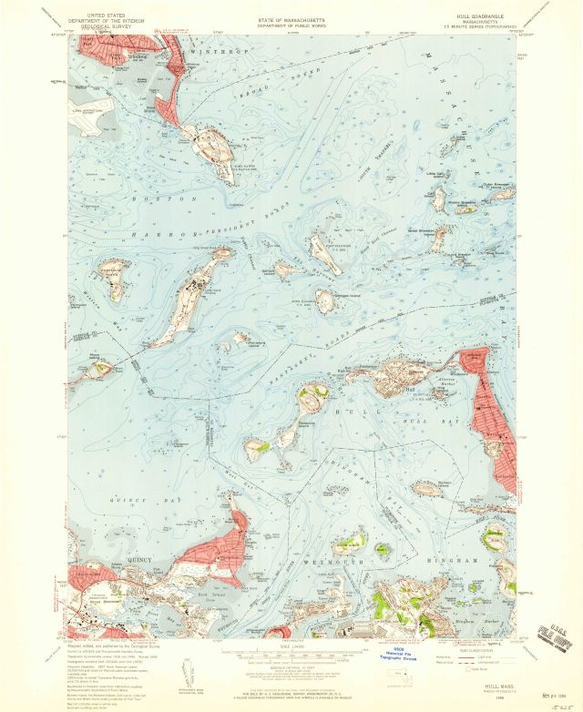
Hull quadrangle, Massachusetts--Middlesex Co. / Mapped, edited, and published by the Geological Survey
Item
- Title
- Description
- Contributor
- Creator
- Format
- Identifier
- Publisher
- Type
- Original Format
- Extent
-
Hull quadrangle, Massachusetts--Middlesex Co. / Mapped, edited, and published by the Geological Survey
-
View map in pdf format
-
Scale 1:24,000
-
Polyconic projection
-
Relief shown by contours and spot heights. Contour interval 10 feet.
-
Topography by planetable surveys 1936 and 1943. Revised 1958.
-
Hydrography compiled from USC&GS chart 246 (1956)
-
Includes quadrangle location map and conversion scales
-
N4215--W7052.5/7.5.
-
7.5 minute series (topographic)
-
Institution: Gloucester Lyceum & Sawyer Free Library
-
Massachusetts. Department of Public Works
-
Geological Survey (U.S.)
-
application/pdf
-
3552624
-
Washington, D.C. : U.S. Geological Survey
-
cartographic
-
Maps
-
Topographic maps
-
1 map : color
-
58 x 43 cm., on sheet 69 x 57 cm.
- Item sets
- Gloucester Map Collection
- Media
 AS008_640.jpg
Position: 1842 (125 views)