
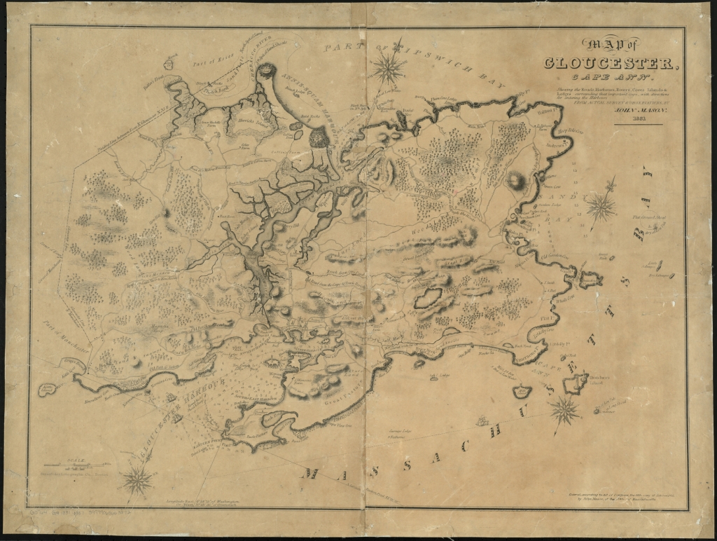
Map of Gloucester, Cape Ann : shewing the roads, harbours, rivers, coves, islands & ledges surrounding that important Cape, with directions for entering the harbours
Item
- Title
- Description
- Contributor
- Creator
- Format
- Identifier
- Publisher
- Type
- Original Format
- Extent
-
Map of Gloucester, Cape Ann : shewing the roads, harbours, rivers, coves, islands & ledges surrounding that important Cape, with directions for entering the harbours
-
View map in pdf format
-
From the actual survey & observation by John Mason. Entered according to Act of Congress, the 16th day of October, 1830, by John Mason of the state of Massachusetts.
-
View map in the Boston Public Library Leventhal Map Collection
-
Institution: Gloucester Lyceum & Sawyer Free Library
-
Mason, John
-
application/pdf
-
3550895
-
Boston : Senefelder Lithographic Co
-
cartographic
-
Maps
-
1 map : b&w
-
58 x 74 cm.
- Item sets
- Gloucester Map Collection
Position: 204 (241 views)