
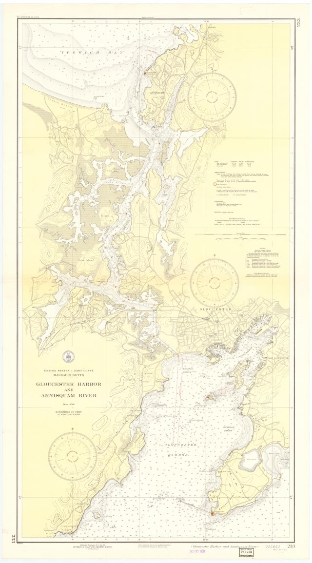
United States--east coast, Massachusetts, Gloucester Harbor and Annisquam River / Coast and Geodetic Survey
Item
- Title
- Description
- Contributor
- Creator
- Format
- Identifier
- Publisher
- Subject
- Type
- Original Format
- Extent
-
United States--east coast, Massachusetts, Gloucester Harbor and Annisquam River / Coast and Geodetic Survey
-
Massachusetts, Gloucester Harbor and Annisquam River
-
Gloucester Harbor and Annisquam River
-
View map in pdf format
-
Scale 1:10,000
-
Depths shown by isolines and soundings
-
Relief shown by contours and hachures
-
Soundings in feet at mean low water
-
Includes tidal information
-
Institution: Gloucester Lyceum & Sawyer Free Library
-
U.S. Coast and Geodetic Survey
-
application/pdf
-
3550630
-
Washington, D.C. : United States Coast and Geodetic Survey
-
Harbors
-
Navigation
-
cartographic
-
Maps
-
1 map : color
-
110 x 62 cm.
- Item sets
- Gloucester Map Collection
- Media
 AS035_640.jpg
Position: 17806 (1 views)