
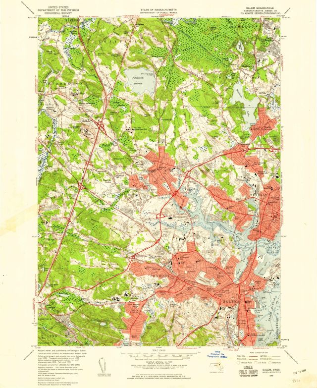
Salem quadrangle, Massachusetts -- Essex Co. / Mapped, edited and published by the Geological Survey
Item
- Title
- Description
- Contributor
- Creator
- Format
- Identifier
- Publisher
- Type
- Original Format
- Extent
-
Salem quadrangle, Massachusetts -- Essex Co. / Mapped, edited and published by the Geological Survey
-
Salem, Mass.
-
Salem quadrangle Massachusetts, Essex County
-
Salem quadrangle
-
View map in pdf format
-
Scale 1:24,000
-
Topography by planetable surveys 1942. Culture revised by photogrammetric methods from aerial photographs taken 1955. Field check 1956.
-
Relief shown by spot heights, soundings and contours.
-
Contour interval 10 feet
-
At top of map: State of Massachusetts Department of Public Works
-
1000-meter Universal Transverse Mercator grid ticks, zone 19, shown in blue
-
N4230--W7052.5/7.5
-
7.5 minute series (topographic)
-
Institution: Gloucester Lyceum & Sawyer Free Library
-
Massachusetts. Department of Public Works
-
Geological Survey (U.S.)
-
application/pdf
-
3549820
-
Washington, D.C. : United States Geological Survey
-
cartographic
-
Maps
-
Topographic maps
-
1 map : color
-
58 x 43 cm.
- Item sets
- Gloucester Map Collection
- Media
 AS018_640.jpg
Position: 465 (207 views)