-
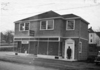
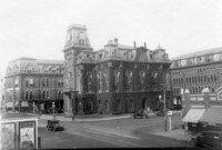
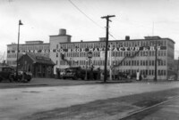
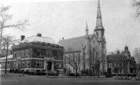 YMCA, Baptist church, Lafayette bldg., April 1930
-
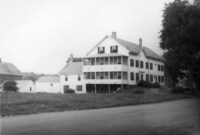
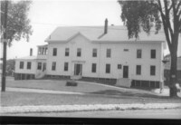
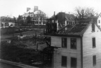
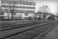
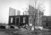 Tearing down old Woodville School, 1920
-
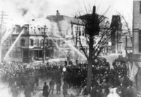
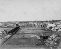
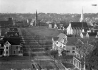 View looking west from top of Town Hall, 1896
-
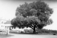 [Willow tree on Water Street]
 Photograph taken on July 19,1931.;"This willow tree grew from a stake driven in the ground 4 ft. x 2" by road builders about 1906. #87 Water Street at left." - Text from back of photograph.
-
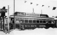
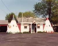
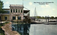
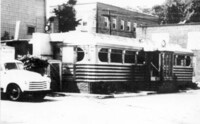 [Walsh's Diner, Wakefield, Mass.]
 Photo shows Walsh's Diner, located at the corner of Main and West Water Streets, on what is now the parking lot of Eastern Bank. It operated from 1936 until 1950.
-
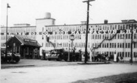 [L.B. Evans' Son Co. Shoe Manufacturers, Wakefield, Mass.]
 Photograph shows L.B. Evans' Son Co. Shoe Manufacturers on Water Street. Also visible is the Arthur H. Saunders Gulf service station. The factory building was sold in 1979 and the company phased out its operations. It has since been converted for office use.
-
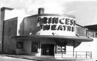 [Princess Theatre, Wakefield, Mass.]
 Photo shows the Princess Theatre, which opened on Mechanic Street (later Princess Street) in 1912. The building was torn down in 1971.
-
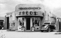 [Fred's Service Station, Wakefield, Mass.]
 Photo shows Fred's gas station, located at the corner of Main and West Water Streets, on what is now the parking lot of Eastern Bank.
-
 [Walsh's Diner, Wakefield, Mass.]
 Photo shows Walsh's Diner, located at the corner of Main and West Water Streets, on what is now the parking lot of Eastern Bank. It operated from 1936 until 1950.
-
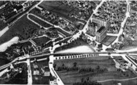 Aerial drawing of Cyrus Wakefield Estate, Wakefield, Mass.
 Image is a portion of a drawn aerial map showing the Cyrus Wakefield estate once located on Main Street on the site of the present Galvin Middle School. The mansion was sited approximately opposite Richardson Street, on what is now the school parking lot. The Wakefield estate covered hundreds of acres on both sides of Main Street, and included most of the land bounded by West Water Street, Main Street, and North Avenue, as well as most of the land between Water Street and Bennett Street. The large stone mansion was built in the early 1860s in Second Empire mansard style, and was complemented by a barn, gazebo, greenhouses, canals and orchards on the grounds which extended back to North Avenue. Cyrus Wakefield died in 1873, and the house was then occupied by his widow, Eliza Bancroft Wakefield, who died in 1877. The estate passed into the hands of relatives, as Cyrus and Eliza had no children. The Town voted to buy the property in 1913 at a cost of $25,000. A few years later, the town voted to use the property as the site for a new school building. The mansion, which had fallen into disrepair, was torn down on October 17, 1921.
-
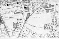 Map of Cyrus Wakefield Estate, Wakefield, Mass.
 Image is a portion of a map showing the Cyrus Wakefield estate once located on Main Street on the site of the present Galvin Middle School. The mansion was sited approximately opposite Richardson Street, on what is now the school parking lot. The Wakefield estate covered hundreds of acres on both sides of Main Street, and included most of the land bounded by West Water Street, Main Street, and North Avenue, as well as most of the land between Water Street and Bennett Street. The large stone mansion was built in the early 1860s in Second Empire mansard style, and was complemented by a barn, gazebo, greenhouses, canals and orchards on the grounds which extended back to North Avenue. Cyrus Wakefield died in 1873, and the house was then occupied by his widow, Eliza Bancroft Wakefield, who died in 1877. The estate passed into the hands of relatives, as Cyrus and Eliza had no children. The Town voted to buy the property in 1913 at a cost of $25,000. A few years later, the town voted to use the property as the site for a new school building. The mansion, which had fallen into disrepair, was torn down on October 17, 1921.;Image is from a map presumed to be a sheet (page 61) from an atlas of Middlesex County, published by George H. Walker of Boston.
-
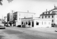 Corner of Water St. & Wakefield Ave., July 23, 1945
-
 [Vernon Market]
 Undated photograph looking west shows the Vernon Market at the corner of Vernon Street and Lawrence Street. The building now contains apartments.
-
 Wakefield town farm, Nahant St, July 13, 1931
-
 Wakefield town farm building, July 5, 1947
-
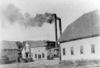
 George H. Taylor store fire, Mar. 5, 1907
-
 Solon Richardson's round stable : site of Richardson Ave., Wakefield, Mass.
-
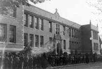 St. Joseph's School flag raising
 Photograph taken on May 8, 1936 shows a flag raising ceremony at the school of St. Joseph's Roman Catholic Church on Gould Street.
-
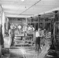 Rattan factory workers
-
 Perkins Block being torn down, Oct. 29, 1940
-
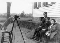 The Payros
 Photograph taken in November, 1909 shows three members of the Payro family being "photographed" by their cat: Edmund, age 12, Ernest, age 8, and Cecilia, age 5.
-
 Taylor Block, Town Hall, piano factory, Sept. 1929
-
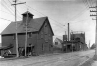
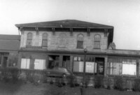
 Old street railway car barns & power house
 Photograph taken in 1895 shows a rear view, looking north, of the car barns and power house for the street railway cars on Water Street.
-
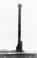 Man on top of rattan factory chimney
 Photograph taken in 1900 shows a man on top of the remains of the chimney of the Wakefield Rattan Company factory on Water Street. The approximately 180-foot chimney had been struck by lightning on March 12, 1899.
-
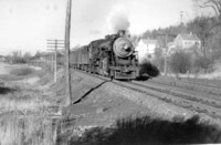 Near Crystal Lake
 Photograph taken on December 24, 1939 shows a locomotive heading south towards Melrose along the shore of Crystal Lake in Greenwood. The Harts Hill forest fire watch tower is visible in the upper right.
-
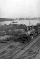 View from Greenwood Bridge
 Photograph taken in 1916 shows a locomotive heading south towards Melrose along the shore of Crystal Lake in Greenwood.
-
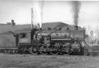 [Locomotive at Center Depot]
 Photograph taken on February 21, 1938 at 10 a.m. shows a railroad lococomotive at Wakefield's Center Depot on Water Street.
-
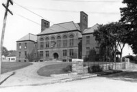 Lincoln School
 Photograph taken on August 5, 1905 shows the Lincoln School at the corner of Crescent and Otis Streets. The school was built in 1892 and is now used for elderly housing.
-
 Bayrd's Indian Trading Post at 52 Main Street, Wakefield, Mass.
 Detailed entry in building survey, "The cultural resources of Wakefield", pA4.;Photo courtesy of the Bayrd family.
-
 Hathaway stable fire ruins, Oct. 23, 1899
-
 [Wakefield Rifle Range mascots]
 Photographs shows members of the Wakefield Rifle Range, formerly Camp Plunkett, with animal mascots. In one photo a goat, and in the other a parrot.
-
 Gas house on North Avenue
-
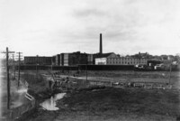 Rattan factory buildings
-
 L.B. Evans' Son Co. Shoe Manufacturers
 Photograph taken on December 3, 1936 shows L.B. Evans' Son Co. Shoe Manufacturers on Water Street. Also visible is the Arthur H. Saunders Gulf service station. The factory building was sold in 1979 and the company phased out its operations. It has since been converted for office use.
-
 [L.B. Evans' Son Co. Shoe Manufacturers]
 Photograph taken on December 5, 1943 shows L.B. Evans' Son Co. Shoe Manufacturers and adjacent railroad tracks on Water Street. The factory building was sold in 1979 and the company phased out its operations. It has since been converted for office use.
-
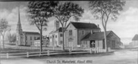 Church St. Wakefield
-
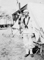
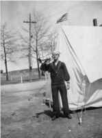 Charles Lamont, our bugler
 Photograph shows the bugler, Charles Lamont, outside his tent at the Wakefield Rifle Range, formerly Camp Plunkett.
-
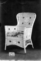 Rattan furniture photographs
-
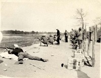 [Wakefield Rifle Range assorted photographs]
 Collection of photographs showing various buildings and members of the Wakefield Rifle Range, formerly Camp Plunkett.
-
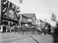 [Wakefield Rifle Range marchers]
 Photographs shows members of the Wakefield Rifle Range, formerly Camp Plunkett, marching in various settings.
-
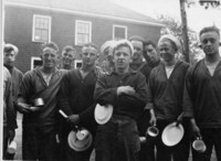 Chow line, Wakefield Rifle Range
 Photograph shows the mess hall line at the Wakefield Rifle Range, formerly Camp Plunkett.
-
 [Buglers at Wakefield Rifle Range]
 Photograph shows the buglers Bentley and Charles Lamont at the Wakefield Rifle Range, formerly Camp Plunkett.
-
 Lucius Beebe sets a style
-
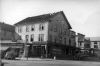
 Old bank building
 Photograph shows the former bank building at the corner of North Avenue and Albion Streets. It housed several banks over the years including the South Reading Mechanic and Agricultural Institution, the National Bank of South Reading, the Wakefield National Bank, and the Wakefield Trust Company. Also visible in the photo is a sign for Beasley's Variety Store.
-
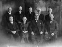 Nine 50 year employees of the Heywood-Wakefield Co. in 1928
-
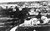 South Reading (Wakefield) from Hart's Hill
-
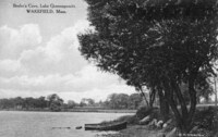
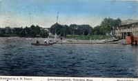
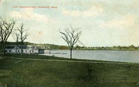
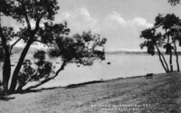 At Lake Quannapowitt, Wakefield, Mass.
 Postcard shows a view of the eastern shore of Lake Quannapowitt.
-
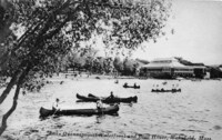
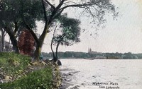 Wakefield, Mass. from lakeside
 Postcard shows a view looking south from the eastern shore of Lake Quannapowitt. The boat house and the towers of the Baptist and Congregational churches are visible in the distance.
-
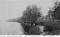
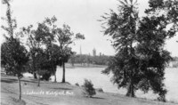 Lakeside, Wakefield, Mass.
 Postcard shows a view looking southwest from the eastern shore of Lake Quannapowitt. The towers of the Baptist and Congregational churches are visible in the distance.
-
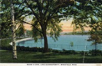 Beebe's Cove,Lake Quannapowitt, Wakefield, Mass.
 Postcard shows a view looking south towards the Common from Beebe Cove on the east shore of Lake Quannapowitt.
-
 Lakeside, Wakefield, Mass.
 Postcard shows a view of the eastern shore of Lake Quannapowitt.
-
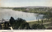
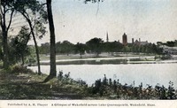 A glimpse of Wakefield across Lake Quannapowitt, Wakefield, Mass.
 Postcard shows a view looking southwest from Main Street across the Common toward the boathouse at the end of Lake Street on the southern shore of Lake Quannapowitt. The spires of the Congregational and Baptist churches are visible.
-
 Beebe's Cove, Lake Quannapowitt, Wakefield, Mass.
 Postcard shows a view of Beebe Cove on the east shore of Lake Quannapowitt.
-
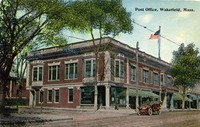 Post Office, Wakefield, Mass.
 Postcard shows a view of the 1860 Richardson Block on the northwest corner of Main Street and Richardson Avenue. The Wakefield Post Office was located in the building from 1901 until 1924, when it moved to a building on Albion Street.
-
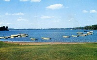
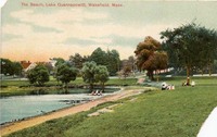 The beach, Lake Quannapowitt, Wakefield, Mass.
 Postcard shows a view looking east of the beach on the southern shore of Lake Quannapowitt.
-
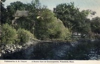 A beauty spot on Quannapowitt, Wakefield, Mass.
 Postcard shows a view of an unidentified spot on the shore of Lake Quannapowitt.
-
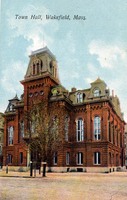 Town Hall, Wakefield, Mass.
 Postcard shows a view of Wakefield Town Hall, completed in 1871. The land and funds for the building were donated by industrialist Cyrus Wakefield, for whom the town is named. The building was demolished in 1958 after it was damaged by fire in December, 1950.
-
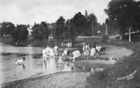 Lake Quannapowitt beach
 Postcard shows a view of the beach on the southern shore of Lake Quannapowitt.
-
 [Lake Quannapowitt, Wakefield, Mass.]
 Postcard shows a view looking north from the Common across Lake Quannapowitt.;"The beautiful lake named for a local Indian chief is popular for bathing, boating, and skating." -- Text from back of postcard.
-
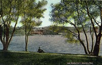
 The elms beside Lake Quannapowitt, Wakefield, Mass.
 Postcard shows a view of elm trees along the Main Street shore of Lake Quannapowitt.
-
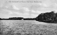 Lake Quannapowitt and Rosson's boat house, Wakefield, Mass.
 Postcard shows a view north over Lake Quannpowitt with Rosson's boat house on the far shore.
-
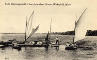 Lake Quannapowitt view from boat house, Wakefield, Mass.
 Postcard shows a view of the dock at the boathouse at the end of Lake Street on the southern shore of Lake Quannapowitt.
-
 A glimpse of Quannapowitt from the Congregational Church tower, Wakefield, Mass.
 Postcard shows a view northeast from the Congregational Church tower towards Main Street.
-
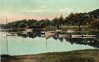
 Quannapowitt Lake, Wakefield, Mass.
 Postcard shows a view of the dock at the boathouse at the end of Lake Street on the southern shore of Lake Quannapowitt.
-
 Lake Quannapowitt, Wakefield, Mass.
 Postcard shows a view from the Common east towards Main Street of boats on Lake Quannapowitt.
-
 Lake Quannapowitt, Wakefield 1907
 Postcard shows a view of the dock at the boathouse at the end of Lake Street on the southern shore of Lake Quannapowitt.
-
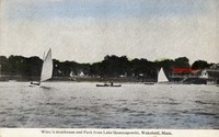 Wiley's Boathouse and Park from Lake Quannapowitt, Wakefield, Mass.
 Postcard shows a view of the boathouse at the end of Lake Street on the southern shore of Lake Quannapowitt.
-
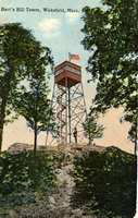 Hart's Hill tower, Wakefield, Mass.
 Postcard shows the Hart's Hill forest fire watch tower built at the summit of Hart's Hill in 1913 by the state Forestry Department. The tower was approximately 50 feet tall.
-
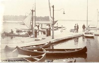 Lake Quannapowitt, 1907
 Postcard shows a view of the dock at the boathouse at the end of Lake Street on the southern shore of Lake Quannapowitt.
-
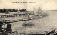
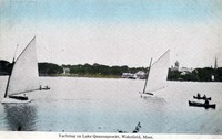 Yachting on Lake Quannapowitt, Wakefield, Mass.
 Postcard shows a view looking south across Lake Quannapowitt toward the Common. The boat house, Congregational Church and Baptist Church are visible on the far shore.
-
 Quannapowitt Lake, Wakefield, Mass.
 Postcard shows a view looking west from Main Street across the Common toward the boathouse at the end of Lake Street on the southern shore of Lake Quannapowitt.
-
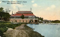 Wiley's Boat house & Cubberly's Dance Hall, Wakefield, Mass.
 Postcard shows a view looking west from Main Street across the Common toward the boathouse at the end of Lake Street on the southern shore of Lake Quannapowitt.
-
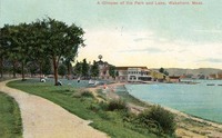 A glimpse of the park and lake, Wakefield, Mass.
 Postcard shows a view looking west from Main Street across the Common toward the boathouse at the end of Lake Street on the southern shore of Lake Quannapowitt.
-
 Lake Quannapowitt, Wakefield, Mass.
 Postcard shows a view looking west from Main Street toward the boathouse at the end of Lake Street on the southern shore of Lake Quannapowitt.;"Looking toward the old Boat House before it was torn down." -- Text from back of postcard.
-
 Lake Quannapowitt, Wakefield, Mass.
 Postcard shows a view looking east of boaters and the boathouse at the end of Lake Street on the southern shore of Lake Quannapowitt.
-
 Lake Quannapowitt waterfront and boat house, Wakefield, Mass.
 Postcard shows a view of boaters and the boathouse at the end of Lake Street on the southern shore of Lake Quannapowitt.
-
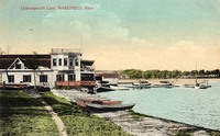
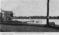 The boat house Lake Quannapowitt, Wakefield, Mass.
 Postcard shows a view of Wiley's boathouse at the end of Lake Street on the southern shore of Lake Quannapowitt.
-
 Lake Quannapowitt, Wakefield, Mass.
 Postcard shows a view looking west from Main Street over the southern shore of Lake Quannapowitt. Wiley's boathouse and the icehouses are visible in the distance on the opposite shore.
-
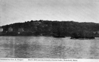 Hart's Hill and the islands Crystal Lake, Wakefield, Mass.
 Postcard shows a view over Crystal Lake looking east from the west shore. The rocky top of Hart's Hill is visible in the background above the houses on Main Street.
-
 Lake Quannapowitt, Wakefield, Mass.
 Postcard shows a view looking west from Main Street over the southern shore of Lake Quannapowitt. Wiley's boathouse is on the left. Lakeside Cemetery is visible in the distance on the opposite shore.
-
 Glimpse of the boat house Lake Quannapowitt, Wakefield, Mass.
 Postcard shows a view of Wiley's boathouse and the ice houses at the end of Lake Street on the southern shore of Lake Quannapowitt.
-
 Lake Quannapowitt, Wakefield, Mass.
 Postcard shows a view of Wiley's boathouse and the ice houses at the end of Lake Street on the southern shore of Lake Quannapowitt.
-
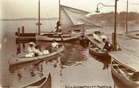
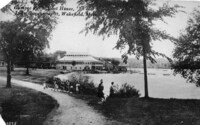
 Boat house at Lake Quannapowitt, Wakefield, Mass.
 Postcard shows a view of Wiley's boathouse at the end of Lake Street on the southern shore of Lake Quannapowitt.
-
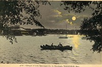 Glimpse of Lake Quannapowitt by moonlight, Wakefield, Mass.
 Postcard shows a view from Main Street looking west over the southern shore of Lake Quannapowitt. The Wiley boathouse and ice houses are visible in the background.
-
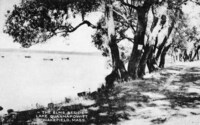
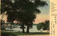 The Willows, Lake Quannapowitt, Wakefield, Mass.
 Postcard shows a view from Main Street looking west over the southern shore of Lake Quannapowitt. The Wiley boathouse and ice houses are visible in the background.
-
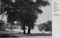 The Willows, Lake Quannapowitt, Wakefield, Mass.
 Postcard shows a view from Main Street looking west over the southern shore of Lake Quannapowitt. the Wiley boathouse and ice houses are visible in the background.
-
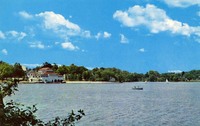
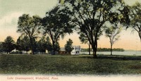 Lake Quannapowitt, Wakefield, Mass.
 Postcard shows a view north over Wakefield Common to Lake Quannapowitt. The Wiley Boathouse is visible in the background.
-
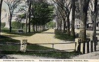 The Common and Soldiers' Monument, Wakefield, Mass.
 Postcard shows a view of Wakefield Common with the Soldiers and Sailors Memorial, erected in 1902 to commemorate Wakefield's Civil War casualties, in the background.
-
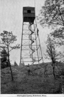 Hart's Hill tower, Wakefield, Mass.
 Postcard shows the Hart's Hill forest fire watch tower built at the summit of Hart's Hill in 1913 by the state Forestry Department. The tower was approximately 50 feet tall.
-
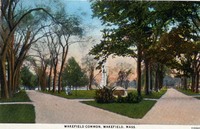 Wakefield Common, Wakefield, Mass.
-
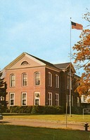 [Wakefield Town Hall]
 Postcard shows the Town Hall on Wakefield Common at Lafayette Street. Built in 1871, the building was used as the town's high school until 1937, when it was remodeled as part of a WPA project for municipal offices. The building is now also known as the Lafayette building.
-
 The Common, Wakefield, Mass.
-
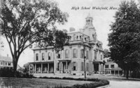 High School, Wakefield, Mass.
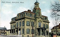
 Postcard shows the High School on Wakefield Common at Lafayette Street. Built in 1871, the building was used for school purposes until 1937, when it was remodeled as part of a WPA project for municipal offices. The building, also known as the Lafayette building, is now Wakefield's Town Hall.
-
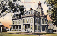 High School, Wakefield, Mass.
 Postcard shows the High School on Wakefield Common at Lafayette Street. Built in 1871, the building was used for school purposes until 1937, when it was remodeled as part of a WPA project for municipal offices. The building, also known as the Lafayette building, is now Wakefield's Town Hall.
-
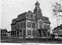 High School, Wakefield, Mass.
 Postcard shows the High School on Wakefield Common at Lafayette Street. Built in 1871, the building was used for school purposes until 1937, when it was remodeled as part of a WPA project for municipal offices. The building, also known as the Lafayette building, is now Wakefield's Town Hall.
-
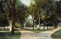
 The Rockery, Wakefield, Mass.
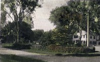
 Postcard shows the Rockery on Main Street, looking north toward the Common.
-
 The Rockery, Wakefield, Mass.
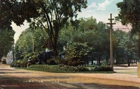
 Postcard shows the Rockery on Main Street, looking north toward the Common.
-
 High School, Wakefield, Mass.
 Postcard shows the High School on Wakefield Common at Lafayette Street. Built in 1871, the building was used for school purposes until 1937, when it was remodeled as part of a WPA project for municipal offices. The building, also known as the Lafayette building, is now Wakefield's Town Hall.
-
 Rockery Main Street, Wakefield, Mass.
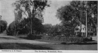
 Postcard shows the Rockery on Main Street, looking north.
-
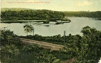 Crystal Lake and islands, Wakefield, Mass.
 Postcard shows a view over Crystal Lake looking roughly southwest. The railroad line from Boston is visible in the foreground.