Map of Salem and Surrounding Places
Item
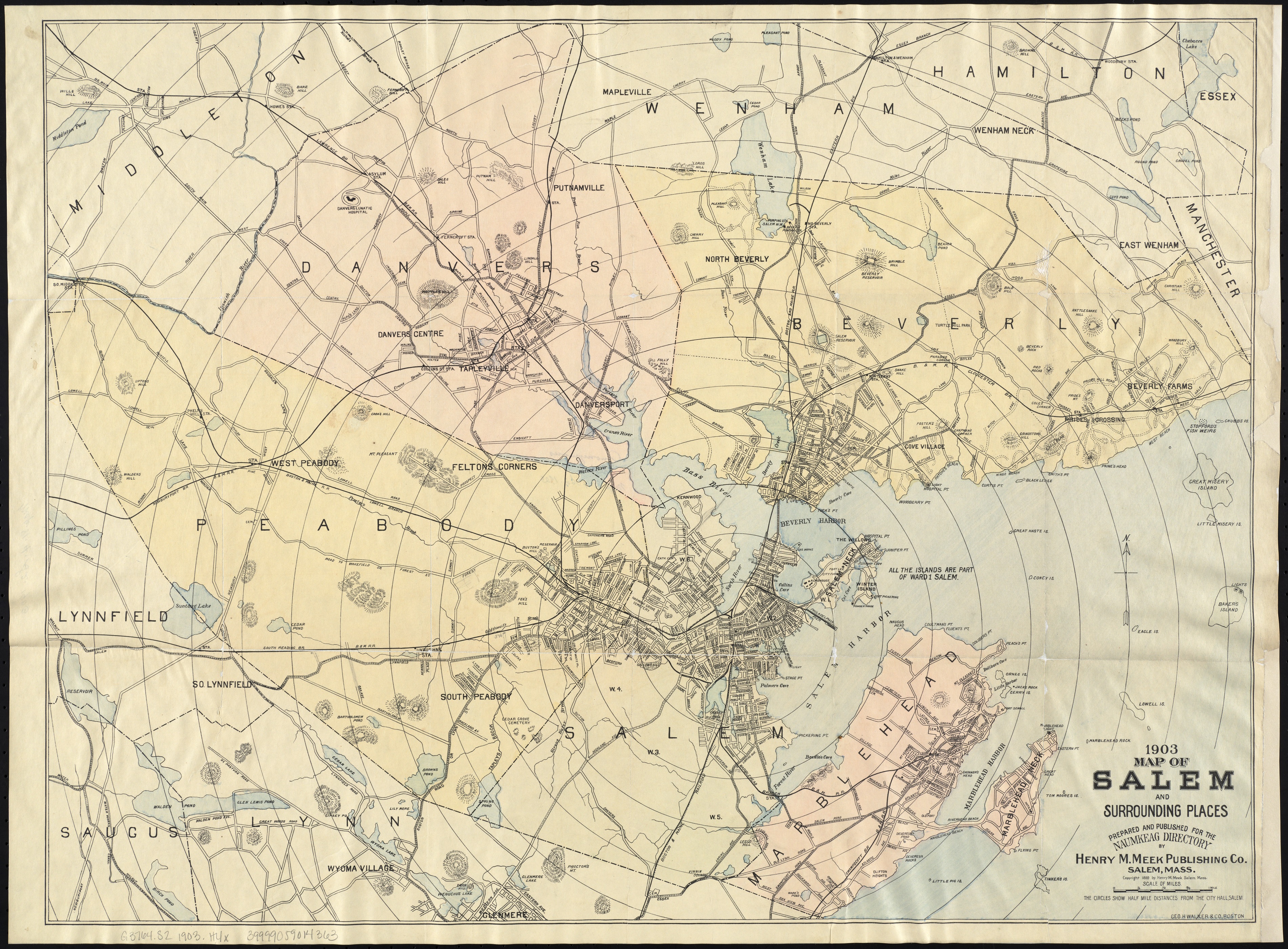
- Title
- Description
- Creator
- Date
- Coverage
- Contributor
- Publisher
- Rights
- Format
- Language
- Source
- Type
-
Map of Salem and Surrounding Places
-
Map of Salem and surrounding places in 1906, prepared and published for the Naumkeag Directory. Includes street detail for Salem, Beverly, Danvers and Marblehead. Digital copy available at the Norman B. Leventhal Map Center.
-
Meek, Henry M.
-
1906
-
Massachusetts--Essex (county)--Salem
-
Massachusetts--Essex (county)--Beverly
-
Massachusetts--Essex (county)--Danvers
-
Massachusetts--Essex (county)--Marblehead
-
Institution: Salem Public Library
-
Institution: Boston Public Library
-
Henry M. Meek Publishing Co. Salem, Mass
-
No copyright restrictions.
-
image/jpg
-
eng
-
Norman B. Leventhal Map Center
-
cartographic
- Item sets
- Salem Maps
- Media
 1903_Meek(med).jpg
Position: 2088 (118 views)