Items
-
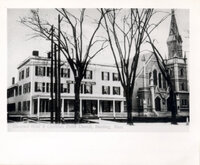 Christian Union Church "Cornerstone laid October 6, 1870. Erected on the east side of Main Street, next to the Reading Inn. Its name was changed to Unitarian Church of Reading in October 1919. The church was torn down ca. 1920." -- From the album containing the photograph
 -
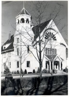 [First Baptist Church] "During the first part of the 1900s, the Baptist Church was renovated, and it stood until destroyed by fire on February 23, 1965." -- From the album containing the photograph
 -
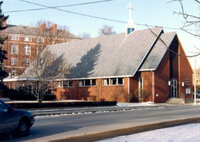 [First Baptist Church] "New church was built on the site in 1967." -- From the album containing the photograph
 -
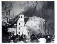 [Fire at First Baptist Church] "The Baptist Church on the corner of Woburn and Sanborn Streets was destroyed by fire." -- From the album containing the photograph
 -
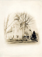 Baptist Church, Woburn Street 45 Woburn Street, Reading, MA, 01867
 -
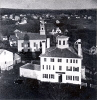 Baptist Church on Salem Street "Was built ca. 1832." -- From the album containing the photograph
 -
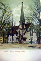 Baptist Church, Reading, Mass. "When a larger church was needed, members built a new one on Woburn Street, corner of Linden Street, and it was completed in 1884." -- From the album containing the photograph
 -
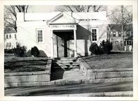 Church of the Nazarene 85 Woburn Street, Reading, MA, 01867
 -
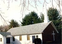 Church of the Nazarene 900 Main Street, Reading, MA, 01867
 -
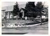 Episcopal Church of the Good Shepherd "Woburn and Chute Streets. Built in 1925." -- From the album containing the photograph
 -
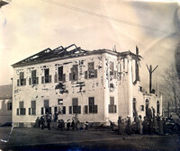
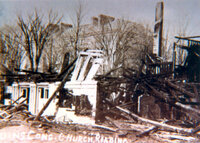 Congregational church fire "Ruins Cong. Church Reading." Written on the photograph.;
 -
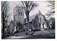 Congregational Church "Rebuilt in 1911." -- From the album containing the photograph
 -
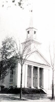 Bethesda Congregational Church "Woburn Street corner of Sanborn Street. Built ca. 1850." -- From the album containing the photograph
 -
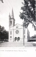 [Bethesda Congregational Church] "Photo of 'refaced' Bethesda church. Reconstruction work done in 1886. Church burned in 1909. See next page." -- From the album containing the photograph
 -
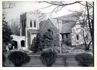 First Church of Christ Scientist "Corner of Lowell and Sanborn Streets, completed August 8 1913." -- From the album containing the photograph
 -
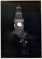
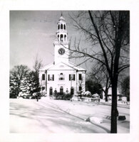 Old South Church "Old South Church, rebuilt after fire, in 1913. Note white clockface." -- From the album containing the photograph
 -
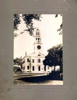 [Old South Methodist Church] "1905. Note power cables and no telephone wires. Note old clock face is black-opaque with gold-plated brass numerals, not the transilluminated clock of after the fire. Note barrier gate to swing across Salem Street. In my day there was a chain there. I know, I ran into it on my bike at dusk in 1934. Quite an experience." From the album containing the photograph - unknown author.
 -
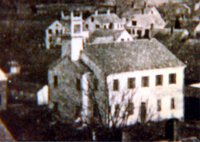
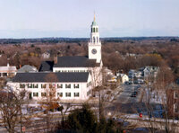 [Old South Methodist Church] "1992 photo of Old South Methodist Church from top floor of Community Center"
 -
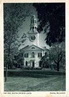 The Old South Church 1818 "1945 - Duo-print photogravure by Samuel Chamberlain AIA. Probably 5x7 view camera. Mr. Chamberlain was extremely popular, widely published, highly skilled in both photography of buildings and as an architect. His subjects were mainly wood frame dwellings of the American colonial style." -- From the album containing the photograph
 -
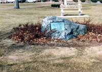 [Site of first meeting house in Reading, MA] "This stone on Reading Common marks the site of the first meeting house erected in Reading in 1769. That meeting house was moved to Union Street in 1818. It was then called Union Hall and converted to a school. In 1887, Union Hall was again moved. It was cut in half and the two sections were taken to lower Haven Street to become part of the huge Black's Block." -- From the album containing the photograph
 -
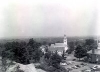 Two views of Old South Church "Taken from the roof of the Community Center."
 -
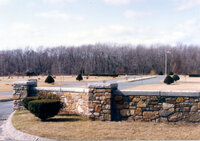 Charles Lawn Cemetery "Developed in 1980." -- From the album containing the photograph
 -
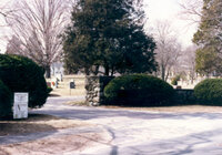 Forest Glen Cemetery "Developed in 1925." -- From the album containing the photograph
 -
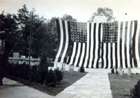 World War [I] memorial "Dedication services May 28, 1939 at the entrance to Laurel Hill Cemetery. Erected in honor of those Reading citizens who served their country in the World War." -- From the album containing the photograph
 -
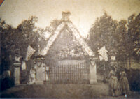 Laurel Hill Cemetery entrance "Decoration Day 1871 photo from Stereoptican print."
 -
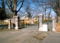 Laurel Hill cemetery entrance "Laurel Hill Cemetery belonged to the Old South Church, and in 1853 they voted to give it to the town of Reading. The first burial in the original cemetery was December 7, 1737." -- From the album containing the photograph
 -
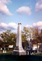 Laurel Hill cemetery "Dedicated October 5 1865, this monument was erected in accordance with the will of Abiel Holden 'to commemorate the deeds and perpetuate the memories of the soldiers of Reading who have been killed in battle or otherwise, or died from disease contracted, or wounds received, while in the service of the United States...'. Mr. Holden bequeated $500 to the town and requested that the town raise another $500, and with the $1000 'shall erect a shaft of Italian marble'. The location in the cemetery of this monument is called Round Hill." -- From the album containing the photograph
 -
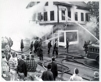 The fire at Paul Doucette's furniture store "Now the site of the Wright Building, Woburn Street." -- From the album containing the photograph
 -
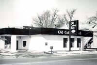 Old Colony Bank "Old Colony Bank, lower Main Street, now Bank of Boston." -- From the album containing the photograph
 -
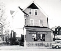 Weston's Greenhouse "Weston's Greenhouse. Main Street and Green Street. Originally on Auburn Street."From the album containing the photograph.
 -
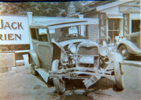 Jack O'Brien's station "Jack O'Brien's station, Salem Street. 1937 photo." -- From the album containing the photograph
 -
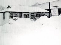
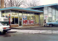 Purple Door Paint Store "The purple door paint store, 46 Harnden Street, business moved from 164 Haven Street." -- From the album containing the photograph
 -
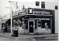 Berson Drug Store "Berson Drug Store, Main Street at Pleasant. Was site of Danforth Drug Store." -- From the album containing the photograph
 -
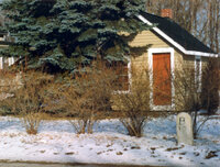 The 12 mile marker from Boston "Ten-footer located on Haverhill opposite Wakefield Street. Notice '12 mile from Boston' marker." -- From the album containing the photograph
 -
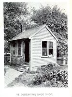 Ye olden-time shoe shop "This 'ten-footer' is pictured in the 1894 Memorial Book [Proceedings of the 250th anniversary of the ancient town of Redding] on page 311. Location unknown." -- From the album containing the photograph
 -
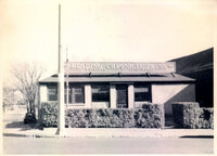 The Reading Chronicle press "Establised in 1970, is a daily publication." -- From the album containing the photograph
 -
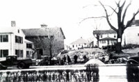 View of Ash Street "Photo taken from Reading Chronicle office front walk (pre-Reading Diner)." -- From the album containing the photograph
 -
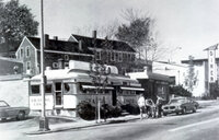 Believe it or not! "An oil painting of our own 'Reading Diner' by John Baeder in 1975 book, 'Book of Diners'." -- From the album containing the photograph
 -
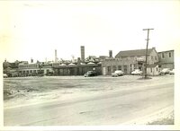 Boston Stove Foundry "John Street" -- from the album containing the photograph
 -
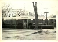 Ace Art Company "Gould Street Reading MA, manufacturers of Nu-Ace corners." -- From the album containing the photograph
 -
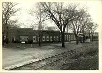 [Goodall Sanford Mills] "Reading Rubber Mills 1980. Goodall Sanford Mills -plastics." -- From the album containing the photograph
 -
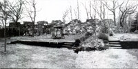 Mayall's experimental lab "This old foundation is what is left of Mr. Thomas Mayall's experimental laboratory. It stands behind the home at 37 Knollwood Road. Mr. Mayall was the owner of the business known as the Reading Rubber Mill[s], which eventually became the Sanford Mills." From the album containing the photograph, text by Miriam Barclay. Note: Sanford Mills was in an adjacent building to the Reading Rubber Mills.
 -
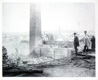 [Photograph of S. Harnden's mill yard after fire] "John DeRonde on left, Ardie Parker on right. House at left margin is 30-32 Elliott Street. Next two houses are 215 and 217 Washington Street. House half-hidden by chimney is 92 Green Street, corner of Elliott Street. House behind man in dark suit is 94 Green Street. Smokestack in background is site of Mayall rubber mill, built in 1882." -- From the album containing the photograph, text by Miriam Barclay
 -
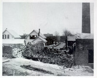 [Photograph of S. Harnden's mill yard after fire] "Twin houses are at the fork of Parker and Haven Streets. House in background is 322 Haven Street, opposite Village Street. Barn to left and back of smoke stack at right edge of photo is in the yard of 309 Haven Street." -- From the album containing the photograph, text by Miriam Barclay
 -
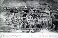 1854 sketch of S. Harnden's mill yard "Destroyed by fire in April 1884. Sketch of Sylvester Harnden's mill yard. Business was started about 1830. When he died in 1873. the business was continued by Edward Manning. The mill yard was located on East Haven Street from Main Street to where Haven Street joins Parker Street today." -- From the album containing the photograph
 -
 [Photograph of S. Harnden's mill yard after fire] "Location of building rubble in the mill yard is unknown."
 -
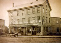 Factory of Henry Austin "Lincoln Street, business circa 1877, plumbing, heating, stoves, bicycles. Copy of photo." From the album containing the photograph.
 -
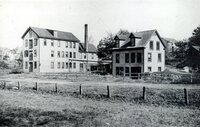 Factory of Charles E. Damon Company "Salem Street. Business circa 1874. Neckties." -- From the album containing the photograph
 -
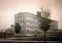 Horton Manufacturing Company "Prescott Street. 1876, paper boxes and hairbrushes." -- From the album containing the photograph
 -
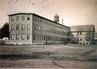 Everett Richardson Factory "Berkeley Street, 1886, shoe manufacturers." -- From the album containing the photograph
 -
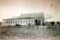 Hutchinson's carriage repository "Established in Reading in 1886 on old Brook's estate." -- From the album containing the photograph
 -
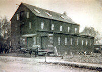 Reading Planing Mill "D. H. Kendall and company, established circa 1840, Salem Street." -- From the album containing the photograph
 -
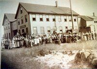 J. W. Richardson shoe factory "Highland Street. The building in the foreground is still standing and is a private home." -- From the album containing the photograph
 -
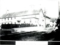 Samuel Pierce organ pipe factory "Pierce Street. Business established in 1846." -- From the album containing the photograph
 -
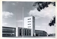 Reading Memorial High School 62 Oakland Road, Reading, MA, 01867
 -
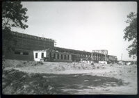 Reading Memorial High School 62 Oakland Road, Reading, MA, 01867
 -
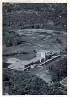 Aerial view of the Reading Memorial High School Built in 1954. -- From the album containing the photograph
 -
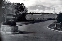 Austin Preparatory School "Willow Street, incorporated 1961" -- From the album containing the photograph
 -
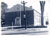 Saint Agnes School "Woburn Street built 1951" from the album containing the photograph.
 -
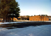 J. W. Killam School "Charles Street elementary built in 1969." -- From the album containing the photograph
 -
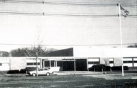 Arthur W. Coolidge Middle School "Built 1961" -- from the album containing the photograph
 -
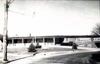 Alice M. Barrow[s] Elementary School "Built 1964 Edgemont Avenue" -- from the album containing the photograph
 -
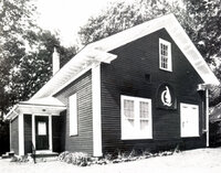 The Quannapowitt Playhouse "Hopkins Street" from the album containing the photograph.
 -
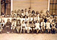 Chestnut Hill School 1941 grades 3 and 4 "Front row left to right: L. Williams F. Elwell L. Alward R. Towle R. Rich J. Lehman R. Holbrook M. Moodie K. Miller M. McNeil D. Shulkey. Middle row left to right: C. Richardson E. Thompson S. Titcombe E. Elwell P. Richardson J. Larson R. Knight R. Anderson A. Sletterink L. Blood N. Johnson B. Castine P. Stevens C. Anderson J. Dagdigian S. Smith. Back row left to right: H. Lander J. Shane R. Berry R. Owen R. Walker M. Hayes B. Brown B. Anderson W. Dear" from the album containing the photograph.
 -
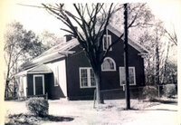 Quannapowitt Playhouse 55 Hopkins Street, Reading, MA, 01867
 -
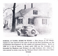 School 19 years : home 96 years "In 1834, the south school district was formed and erected a house on the corner of Summer and Walnut Streets, the locality of the present one. This was used as a school house till 1853 when it was moved to Washington Street, east of Main Street, and converted into a dwelling. The same year the present house was erected on a piece of common land occupied by the old house." "Three Rs at Hill End by the Bishops" From the album containing the photograph."This house at 167 Washington Street was moved to the spot as one of the first buildings on the residential development on the estate of Edmund Parker. Built in 1834 as a school house, it stood until 1853 on the triangle now bounded by Hopkins and Walnut Streets and Summer Ave. whence it was moved to make way for the Walnut Street (later Chestnut Hill) School." from the Reading Chronicle (undated).
 -
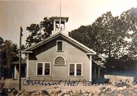 Chestnut Hill School "This school, now the home of Quannapowitt Players, was originally built in 1854, at the triangle of Summer Avenue and Walnut Street (now known as Leach Park). It was called the Walnut Street Schoolhouse. It was moved to its present location on Hopkins Street in 1883 and renamed Chestnut Hill School." -- From the album containing the photograph
 -
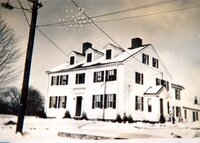 Reading Poor Farm "Pearl Street torn down in 1939" From the album containing the photograph.
 -
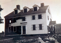 Reading Poor Farm "Note new Pearl Street school in rear" From the album containing the photograph.
 -
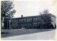 Pearl Street School Building later became Longwood Place. "Built in 1939 on the site of Reading Poor Farm."
 -
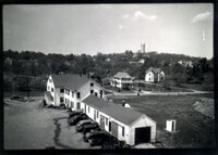 [Reading Poor Farm] The Reading water tower on Locust Street, familiarly known as the Reading Rocket is visible In background.
 -
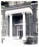 The main entrance to Reading High School "The building was used until 1954, when the increasing school population made the building inadequate. The building then became the Reading Community Center, and then the Schoolhouse Condominiums (1992)."
 -
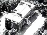 Aerial view Reading High School "[Later became Community Center]
 -
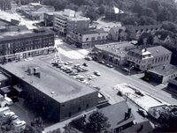 [Aerial views of Reading, Mass., 1965] From the Reading Chronicle files, 1992
 -
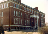 Reading High School "Sanborn Street, erected 1906."
 -
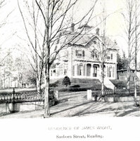 The residence of James Wight, Sanborn Street, Reading Later site of Reading High School, which then became the Reading Community Center, then the Schoolhouse Condominiums.;"This house was situated on the lot where Reading High School was built in 1906, on Sanborn Street."
 -
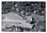 Joshua Eaton School (Elementary) "Built in 1949. Summer Avenue, corner of Oak Street."
 -
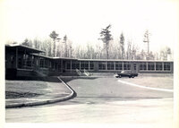 Birch Meadow Elementary School "Built in 1957."
 -
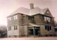 Union Street School "Built ca. 1888. Closed ca. 1939."
 -
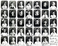 First grade at Union Street School Top row: Shirley Peters Gladys Carter Robert Slaten Helen White Muriel Muese Gordon Goss Julia Eastman. Second row: Betty Johnson Slyva [sic] Batchelder James Doucette Blanshi S. Wilson Powers Albert Doucette Betty Acken. Third row: Helen Toussaint Betty Brown Julian Roberts Jackie White Clifford Dow Collina McLeod Pauline Lewis(?). Fourth row: Loraine Surret Carol Nichols George Rolf Robert Ballou Edward Lewis(?) Edith Hathaway Colan Ware. Bottom row: Frances Philips Verlin Webber James Mellon Helen Malanson Robert Fallon Florence Crowl; Composite photo.
 -
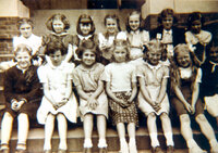 Highland School 1940 second grade "Front row: B. Sansom unknown M. Jigerian E. Flatter M. McSheehy G. Brown S. Sullivan. Back row: B. Johnson J. Baisley J. Crosby P. Connelly A. Whiteneck L. Bryant M. A. Taylor."
 -
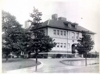 Highland School (elementary) Middlesex Avenue Became Reading Public Library in 1984.;"Built in 1895. Partially destroyed by fire 1957. Closed in 1981."
 -
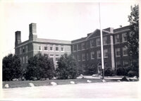 Walter S. Parker Junior High School "Open in 1927."
 -
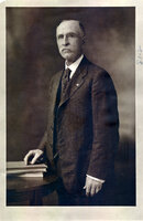 Walter S. Parker Civil War veteran. From a 1931 Boston Globe cut slip glued to back of photo: "Oldest charter member, First Commander and Present Commander of Veteran Post 194 G.A.R."
 -
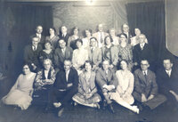 [Reading High School class of 1904 25th reunion] "Reading High School [class of] 25th Anniversary picture Dinner and Meeting at Helen E. Ruggle's, 23 Grand Street, Downtown to local photographers for picture, Back to Grand St. June 1929
 -
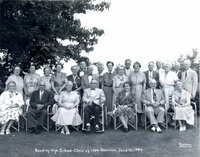 [Reading High School class of 1904 50th reunion] "Reading High School 1904 - 50th Anniversary Colonial Country Club, Lynnfield Mass. June 13, 1954 June 1954
 -
Bare Meadow Conservation AreaBare Meadow is a 125-acre site located in the northeast area of Reading. Bare Meadow was acquired from three major sources between 1972 and 1973. The largest parcel was a gift from Miriam Corey. More acreage was acquired from Reading residents, Mr. Bachelor and Mr. Zilano. The remainder of the land was acquired through smaller purchases. An additional 30 acres was added to Bare Meadow in 1983 by swapping a smaller parcel of highland with a citizen for a desired area. In 2007, the town purchased the abutting Mattera property at 1481 N. Main St., including a cabin. There are four entrances to Bare Meadow, all marked by large brown signs. The two primary entrances are off Pearl St. next to #717 and at the Mattera Cabin at 1481 North Main St. Both have ample off-street parking. The third is off Haverhill St. north of Batchelder Road. Parking is available on Batchelder Rd. The fourth is off Franklin Street next to the Wood End Cemetery. Parking is available in the cemetery and on Partridge Road. Bare Meadow includes a wonderful variety of terrain and plant communities. At the western end there are two small open meadows with long grasses, remnants of an apple orchard. In the center there are beautiful wooded areas and rocky hills with a network of trails that connect with the Northern Area Greenway. The property spans from Main Street to Haverhill Street. Many stone walls mark earlier farming uses of this land. Bare Meadow Brook flows through red maple swamps and open marshes on the western side and joins the Ipswich River at the northern end of the conservation lands. There are six certified vernal pools in Bare Meadow. Many plant species can be found here including lady slippers, partridge berry, marsh marigold, prince s pine, trout lily, witch hazel, and others. Wildlife is plentiful. There are white-tailed deer, red fox, coyote, raccoon, and others. It is a great area for bird-watching. The American woodcock nests here, and in the early spring it performs an amazing courtship flight over the two meadows. Great horned owls nest here and recently, Bluebirds have nested in the bluebird boxes installed in the meadow that can be viewed from a platform at the high spot of the meadow. Recent improvements to Bare Meadow have included the construction of a handicapped accessible trail running approximately 150 yards from the parking lot at the Mattera cabin to a new viewing platform constructed at the highest point overlooking the meadow. In addition, the trails have been cleared and improved with new blazes, boardwalks, signage, and maps. Bare Meadow is a wonderful place to visit year round. Spring brings the advent of wild flowers, nesting birds, and a chorus of frogs calling from the vernal pools. The beautiful oak and pine forest offer a respite from the hot summer days, while in the autumn, Bare Meadow comes alive with the colors of fall. During the winter, folks can enjoy sledding, snowshoeing, and cross-country skiing along the well-marked trails.
-
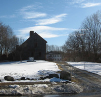 Parker Tavern : 103 Washington Street 103 Washington Street : Parker Tavern. This structure was not built by a Parker nor is it a tavern as we know them today, but it has a long and important history. The house dates from the earliest days of Reading, played an important role in the American Revolution, and even today serves to educate generations of school children. The structure has a stone foundation and wood shingles. It is the town's best-preserved example of the early, central-chimney, saltbox form of architecture. It has a simple Federal door surrounded with pilasters formed of recessed panels, capitals delineated by a narrow molding and shallow projection cornice. The windows are twelve over eight about the cornice. Its actual construction date is open to debate. Some historians feel the house was built in 1694 by Abraham Bryant Jr. and his wife Sarah. Other expert feel the style reflects 1724-25 architectural norms. The house passed from the Bryant family to Deacon Nathaniel Stow and then to Colonel Ebenezer Nichols and his son Ebenezer, Jr. in 1738. Col. Nichols served as an officer in 1722-1724 against the French and Indians and in the expedition against the French at Louisberg, Cape Breton, in 1745. He was in service at Cape Point and was wounded in the battle of Lake George. He became a colonel of a regiment under General Abercrombie at Ticonderoga in 1757, and sold his house the same year. Colonel Nichols is credited with drawing the earliest map of the town, was frequently town moderator and a selectman, and represented the town for nine years in the General Court. The "tavern" days came in Revolutionary times. Ephraim Parker opened the house to boarders and travelers. His most noteworthy tenant was Col. Archibald Campbell who had been taken prisoner after a brief skirmish in Boston Harbor and was held there for a time. Located on one of the original highways, delineated by Col. Nichols in 1764, the house was near a crossroads leading to present-day Wakefield and Woburn. In 1923 it was purchased by the Reading Antiquarian Society, which had the house restored by local architects, Adden and Parker. The society now maintains the tavern as a museum interpreting Reading's history. A caretaker is in residence in a modern structure attached to the house. It is visited each year by all third graders. It is also open to the general public several times a year.
 -
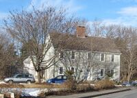 Old Nichols Home : 529 Franklin Street 529 Franklin Street : Old Nichols Home. Settlement in this area of Reading took place after the second land grants were distributed in 1686/7. John Nichols received a parcel at that time. He died in 1721 and probate records are unclear if he had built a house here. His son, Richard Nichols inherited the property but lived only 11 years longer, leaving the house and 143 acres of land to his heirs. A committee of appraisers chose to divide the extensive estate into three parts: Richard's widow receiving one third and two settlements from the remainder. Rather than dividing the land between the six children and therefore rendering it useless for subsistence farming, the eldest son, John, was given first choice of the two settlements. He chose this house including his mother's right to occupy one third, along with a portion of the land. The second oldest son named, Richard, accepted the land to the east where upon he built 483 Franklin Street. The two recipients were to pay their siblings proportionate shares from their father's liquid assets. One of the siblings was Sgt. Joshua Nichols who marched to the alarm of Ft. William Henry in 1757. Another relative, Loea Parker was born here and died at Ft. Independence in 1814. The typical farmhouse with the 5 windows across and a center chimney and entrance is much like its original configuration despite a fire in 1880 that threatened its existence. At that time the nearest fire alarm was on Lowell St. about a mile away, but it was successfully rung. Neighbors took the children to safety, saved much of the furniture and the volunteer fire fighters managed to save the home. The house was uninsured and the owners moved to another location. It is said that charred rafters could still be seen in the attic many years later.
 -
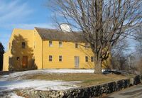 Richard Nichols House : 483 Franklin Street 483 Franklin Street : Richard Nichols House. As if the setting of this house on top of a high rise of land was not enough to catch a passerby's eye, then certainly the pumpkin colored facade makes the old dwelling stand out. Previous owners made the choice of color after extensive research revealed it was an appropriate hue. Those owners also stripped away layers of "improvements" to highlight the massive fireplaces in the center chimney and early wood paneling along with other restoration efforts. A new addition similar to a Beverly jog, can be seen set back from the main house to the west. The offset windows on the easterly end near the street side are evidence of an early extension to the original, traditional structure. Named for its first owner, Richard Nichols, the house is more than 250 years old and provided shelter to generations of Nicholses. Richard Nichols inherited this land division shortly after his father's death in 1732. It is assumed he immediately set out to build this house, for he was married in 1738. The property, and another adjacent Nichols homestead covered over 143 acres and was farmed well into the late 1800s. In 1893, the house was sold and the last of the Nichols family departed from the land of their forefathers. There is a Richard Nichols listed as serving at Lexington and Concord and another entry for Richard Nichols, Jr. as a member of the training band. Whether it is entries for the same person or a father and son, there is evidence that a member from this household took up arms to promote our freedom.
 -
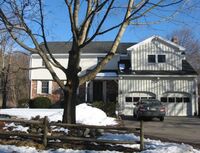 Early Parker House : 458 Franklin Street 458 Franklin Street : Now demolished. It seems a bit unusual to stop at an address that no longer exists and see two contemporary houses that replaced an old homestead. Although all vestiges of the past are erased from the site, the story of the place is of interest. In 1976 a major fire destroyed most of another early Parker house that had stood here for 250 years! This house sheltered several generations of Parkers and sent off two patriots one an experienced soldier and the other a fatherless 19-year-old boy. The 19 year old was Benjamin Parker, named for his father, Benjamin, who had served in the Colonial Wars in 1754. He died two years later leaving a widow and his 5-month-old son. The "experienced soldier" previously mentioned, was an uncle to the 19-year-old Benjamin. This uncle, Asa Parker, grew up in the house along with his brother, Benjamin and seven siblings. Asa was a corporal in the expedition to Crown Pt. in 1759 during the French and Indian War and carried the same rank on April 19, 1775. By 1869, the house left Parker family influence when it and 80 acres were sold to Henry Cook. Cook was a Civil War veteran and was a pallbearer at President Lincoln's funeral. An artist of some recognition, several of Cook's paintings still survive. He later moved to #326 Franklin St. and died in 1920 at the age of 85.
 -
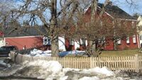 Joseph Parker House : 420 Franklin Street 420 Franklin Street. Surprisingly, Reading's earliest map drawn in 1765 does not show this house and yet historians believe it was built long before the map existed. Ownership can be traced back to the early 1700's when Joseph Parker married Elizabeth Eaton. Her brother died in Annapolis, Nova Scotia while on the expedition against the French in 1712 and his land was left to his brother-in-laws. (Women had no right to inheritance at the time.) It is assumed that the newly married couple set about building a house on the inherited land. The house is and was called a 'half-house', a rather rare structure today. Initially, a half house was built with anticipation that as the family and finances grew, the house would be expanded into the traditional home with 5 windows across the second floor, two windows flanking both sides of the front entrance door and a central chimney. The original facade facing Pasture Road (and facing to the south as most early houses did) has been altered through the years. The three windows on the second floor are in the position to accept a new 'half' with 2 more windows. The original door was under the off centered window above and has been changed to accommodate a first floor window. The Parkers never expanded their house despite raising 5 children here. One son, Ephraim, later became the innkeeper who lent his name to the Parker Tavern on Washington St. Ephraim was also a Minuteman who marched to Lexington and Concord, leaving from the Tavern along with his son, Ephraim Parker, Jr. They were aged 47 and 24 respectively. Joseph, a nephew of Ephraim was born in this house and was also a soldier in the Revolutionary War. He carried the name of his father and grandfather, the original Joseph Parker, who built the house. This Joseph left Reading on April 19th 1775 to march with other Reading Minutemen including his brother, Isaac. Joseph served for 5 days and later enlisted for a longer period when he was promoted to Corporal and later, Sergeant in 1777. Isaac Parker inherited the farm and 60 acres but sold it in 1800 after almost 100 years of Parker family ownership. The Nelson family also held the property for more than 100 years and the place was recognized as a Historic Homestead of Massachusetts in 2002. The late Fred Nelson accepted the certificate just one month before his 100th birthday! His wife, Ellen Nelson, was an artist, a sculptor of figurines, and founder of the Red Farm Studio card company. The house retains the same familiar red hued paint color today. New owners allowed the Historical Commission to observe recent renovations as some interior walls were peeled back revealing the many layers of history and changes. All the house lots on Pasture Road and Blueberry Lane were subdivided during the 20th century from the ancient Joseph Parker homesite.
 -
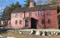 Foster-Emerson house : 409 Grove Street 409 Grove Street : The Foster-Emerson House. The home that now stands at 409 Grove Street was moved from its original location at 288 Grove Street in September of 1998. This house is often referred to as the Foster-Emerson house since three generations of Fosters and three generations of Emersons lived there. Samuel Foster and his wife Sarah came to Reading in 1709. He purchased land from John Brown and the house was built shortly thereafter. He and a son, Abraham, jointly owned a mill that later became the Slab City Saw Mill, one of two early mills in town. When Samuel died in 1762 he left his son and grandson, also Abraham, running the mill. Ebenezer Emerson purchased the house from Samuel's grandson in 1769. Ebenezer served in the Revolution under Captain Thomas Eaton. The Meadow Brook Golf Club, organized in 1898, bought farmland to develop the course and in 1912 purchased the Emerson house, barn and property. The house was used as a residence for the groundskeeper from 1923 until the early 1980's. The barn, used as the clubhouse burned in December of 1948 and a new clubhouse was built. In 1997, the golf club decided that it no longer needed the house. A town wide effort avoided demolition and a bidder was awarded the house and it was moved to its present location. The house, a two and a half story central chimney structure with an asymmetrical 6 bay facade, has undergone many alterations and additions, including partial removal and subsequent replacement of the central chimney. But, exposed framing members, visible in closets and upstairs rooms, indicate that the building retains most of its transitional First Period frame intact.
 -
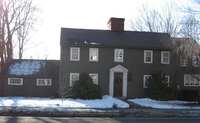 Bancroft homestead : 320 West Street 320 West Street : Bancroft Homestead. This home was built circa 1720, by a descendent of one of Reading's most famous families, the Bancrofts, who settled in Reading in 1673 on woodlots that their parents owned. The house was moved to this location from across the street in 1875. This is a classic "Salt Box" style, one of only three original saltbox styled houses in Reading. Historians have pieced together the history of this house from the will of Thomas Bancroft, Sr. and the marriage record for Thomas Jr. (who was actually the fourth of six Thomas Bancrofts to inhabit Reading). The land records are missing from when Thomas, Jr. married Lydia in 1717, but his father probably gave him the land to build the home now at 320 West Street. By 1730, when Thomas, Sr. died, he deeded additional land to Thomas Jr. as well as part of the yield of his orchard. "Since Thomas has no orchard of his own that bears fruit as yet, my will is my son Thomas shall have apples enough for 4 barrels of cider out of my orchard when it is bearing year and enough for two barrels when it is not the proper bearing year, which he shall have and enjoy for a term of 6 years after my decease." Thomas, Jr. and Lydia raised a family of eight children, one son, also named Thomas, was listed as an officer in the militia, and another son, Joseph, was a lieutenant in the Revolutionary War. Sons Joseph and Moses inherited the home by their father's will in 1747. Joseph inherited the north end of the home and of the chimney, as well as the east side of the cellar. Moses received the south end of the house to the middle of the chimney and the west side of the cellar. Moses moved to Sutton sometime between 1753 and 1756. The house passed through many hands, including three generations of Temples, until Abram Hale purchased land and house, and had the house moved in 1875 onto 16 acres of farmland that he owned. After being sold a number of times, in 1894 Mr. Smith P. Burton purchased it to add to his Elm Hill stock farm. The house was used to lodge hired hands on the farm and became run down. The house is an excellent example of early workmanship when timbers were cut by hand. It has a remarkably solid oak frame and benefited from extensive restoration done after 1932 when the McCabe's purchased the home. The McCabe's faithfully studied and finished the house with authentic touches and the center chimney, which had fallen down when the house was moved, was replaced in 1943.

